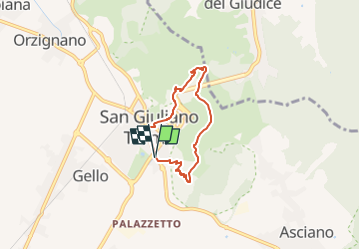
![](/images/other/stat-length.png)
![Tocht Te voet San Giuliano Terme - Anello di San Giuliano Terme - Photo](https://media.geolcdn.com/t/1900/400/1276d57a-5dcf-44d9-8eaa-b8f5f98799e6.jpeg&format=pjpeg&maxdim=2)
Anello di San Giuliano Terme
SityTrail - itinéraires balisés pédestres
Tous les sentiers balisés d’Europe GUIDE+
![Lengte](/images/other/stat-length.png)
Lengte
5 km
![Max. hoogte](https://static1.geolcdn.com/siteimages/upload/files/1508320355ic_sort_altitude_max_24dp.png)
Max. hoogte
221 m
![Positief hoogteverschil](https://static1.geolcdn.com/siteimages/upload/files/1508320355ic_sort_den_pos_24dp.png)
Positief hoogteverschil
254 m
![Km-Effort](/images/other/stat-length.png)
Km-Effort
8,4 km
![Min. hoogte](https://static1.geolcdn.com/siteimages/upload/files/1508320355ic_sort_altitude_min_24dp.png)
Min. hoogte
1 m
![Negatief hoogteverschil](https://static1.geolcdn.com/siteimages/upload/files/1508320355ic_sort_den_neg_24dp.png)
Negatief hoogteverschil
252 m
![Boucle](https://static1.geolcdn.com/siteimages/upload/files/16400158638029165_repeat_loop_refresh_sync_direction_icon.png)
Boucle
Ja
Markering
Datum van aanmaak :
2022-02-15 03:45:50.751
Laatste wijziging :
2022-03-01 00:24:47.163
![Te voet](https://static1.geolcdn.com/sitytour/trail-icons/100.png)
1h54
Moeilijkheid : Gemakkelijk
![Scan deze QR-code om de tocht te openen in de SityTrail-applicatie](https://capi.geolives.com/qq0zvz2zws4bq2lad0pu/sitytour/trails/3114632/qr.png?size=200)
Gratisgps-wandelapplicatie
Over ons
Tocht Te voet van 5 km beschikbaar op Toscane, Pisa, San Giuliano Terme. Deze tocht wordt voorgesteld door SityTrail - itinéraires balisés pédestres.
Beschrijving
Trail created by Comune di San Giuliano Terme.
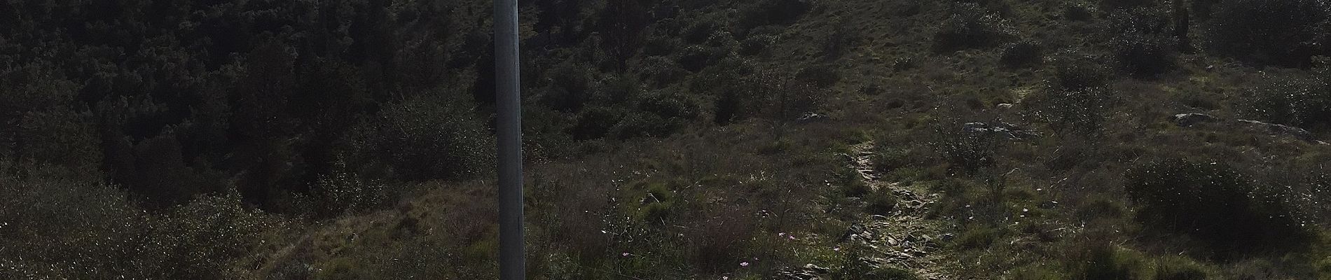
survey data: https://www.strava.com/activities/1474430915
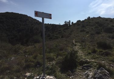
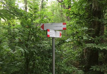
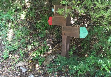
Symbol: 115 on white red flag
Plaatsbepaling
Land:
Italy
Regio :
Toscane
Departement/Provincie :
Pisa
Gemeente :
San Giuliano Terme
Locatie:
Unknown
Vertrek:(Dec)
Vertrek:(UTM)
616095 ; 4846141 (32T) N.
Opmerkingen
Wandeltochten in de omgeving
![Tocht Te voet Pisa - Via degli Acquedotti - Photo](https://media.geolcdn.com/t/375/260/404d95d0-1374-47e0-a890-65d086d97698.jpeg&format=jpg&maxdim=2)
![Te voet Te voet](https://static1.geolcdn.com/sitytour/trail-icons/100.png)
![Tocht Te voet San Giuliano Terme -](https://media.geolcdn.com/t/375/260/c02ad2da-b36e-40e4-9407-ef19456a2cd6.jpeg&format=jpg&maxdim=2)
![Te voet Te voet](https://static1.geolcdn.com/sitytour/trail-icons/100.png)
"Terminetto" da Agnano alla Foce di Calci
Te voet
Gemakkelijk
San Giuliano Terme,
Toscane,
Pisa,
Italy
![](/images/other/stat-length.png)
4 km | 8,4 km-effort
1h 54min
![](https://static1.geolcdn.com/siteimages/upload/files/16400158638029165_repeat_loop_refresh_sync_direction_icon.png)
Neen
![Tocht Te voet San Giuliano Terme -](https://media.geolcdn.com/t/375/260/1276d57a-5dcf-44d9-8eaa-b8f5f98799e6.jpeg&format=jpg&maxdim=2)
![Te voet Te voet](https://static1.geolcdn.com/sitytour/trail-icons/100.png)
"Mirteto" Castellare - Castagno - Mirteto - Foce Pennecchio - Campo di Croce
Te voet
Gemakkelijk
San Giuliano Terme,
Toscane,
Pisa,
Italy
![](/images/other/stat-length.png)
7,6 km | 13,8 km-effort
3h 8min
![](https://static1.geolcdn.com/siteimages/upload/files/16400158638029165_repeat_loop_refresh_sync_direction_icon.png)
Neen
![Tocht Te voet Vecchiano - Anello di Vecchiano - Photo](https://media.geolcdn.com/t/375/260/72df9056-d201-4a69-b4c6-221018b42258.jpeg&format=jpg&maxdim=2)
![Te voet Te voet](https://static1.geolcdn.com/sitytour/trail-icons/100.png)
Anello di Vecchiano
Te voet
Gemakkelijk
Vecchiano,
Toscane,
Pisa,
Italy
![](/images/other/stat-length.png)
6,6 km | 9,9 km-effort
2h 14min
![](https://static1.geolcdn.com/siteimages/upload/files/16400158638029165_repeat_loop_refresh_sync_direction_icon.png)
Ja
![Tocht Te voet Pisa - Sentiero Matilde - Photo](https://media.geolcdn.com/t/375/260/edfe749e-c178-4faa-acaf-8a654b9d5a1d.jpeg&format=jpg&maxdim=2)
![Te voet Te voet](https://static1.geolcdn.com/sitytour/trail-icons/100.png)
![Tocht Te voet San Giuliano Terme -](https://media.geolcdn.com/t/375/260/bd1fe386-bd68-4337-a077-d731449a9a45.jpeg&format=jpg&maxdim=2)
![Te voet Te voet](https://static1.geolcdn.com/sitytour/trail-icons/100.png)
"Chiesino di Monte" da Molina di Quosa alle Croci di Vaccoli
Te voet
Gemakkelijk
San Giuliano Terme,
Toscane,
Pisa,
Italy
![](/images/other/stat-length.png)
3,2 km | 4,4 km-effort
1h 0min
![](https://static1.geolcdn.com/siteimages/upload/files/16400158638029165_repeat_loop_refresh_sync_direction_icon.png)
Neen
![Tocht Te voet San Giuliano Terme -](https://media.geolcdn.com/t/375/260/2998b3f9-f08b-4706-9935-dc5bfdbf7460.jpeg&format=jpg&maxdim=2)
![Te voet Te voet](https://static1.geolcdn.com/sitytour/trail-icons/100.png)
"La Costia" la Polla - la Costia - Foce Pennecchio - Valico della Conserva
Te voet
Gemakkelijk
San Giuliano Terme,
Toscane,
Pisa,
Italy
![](/images/other/stat-length.png)
3,7 km | 7 km-effort
1h 35min
![](https://static1.geolcdn.com/siteimages/upload/files/16400158638029165_repeat_loop_refresh_sync_direction_icon.png)
Neen
![Tocht Stappen Pisa - Pise - Photo](https://media.geolcdn.com/t/375/260/ext.jpg?maxdim=2&url=https%3A%2F%2Fstatic1.geolcdn.com%2Fsiteimages%2Fupload%2Ffiles%2F1553511878bg_sport_marche.png)
![Stappen Stappen](https://static1.geolcdn.com/sitytour/trail-icons/101.png)
![Tocht Stappen Pisa - Pise - Tour à montagne via agnano - Photo](https://media.geolcdn.com/t/375/260/ext.jpg?maxdim=2&url=https%3A%2F%2Fstatic1.geolcdn.com%2Fsiteimages%2Fupload%2Ffiles%2F1553511878bg_sport_marche.png)
![Stappen Stappen](https://static1.geolcdn.com/sitytour/trail-icons/101.png)
Pise - Tour à montagne via agnano
Stappen
Gemakkelijk
Pisa,
Toscane,
Pisa,
Italy
![](/images/other/stat-length.png)
32 km | 48 km-effort
5h 36min
![](https://static1.geolcdn.com/siteimages/upload/files/16400158638029165_repeat_loop_refresh_sync_direction_icon.png)
Neen